Saturday, April 20, 2013

1st day of Summer

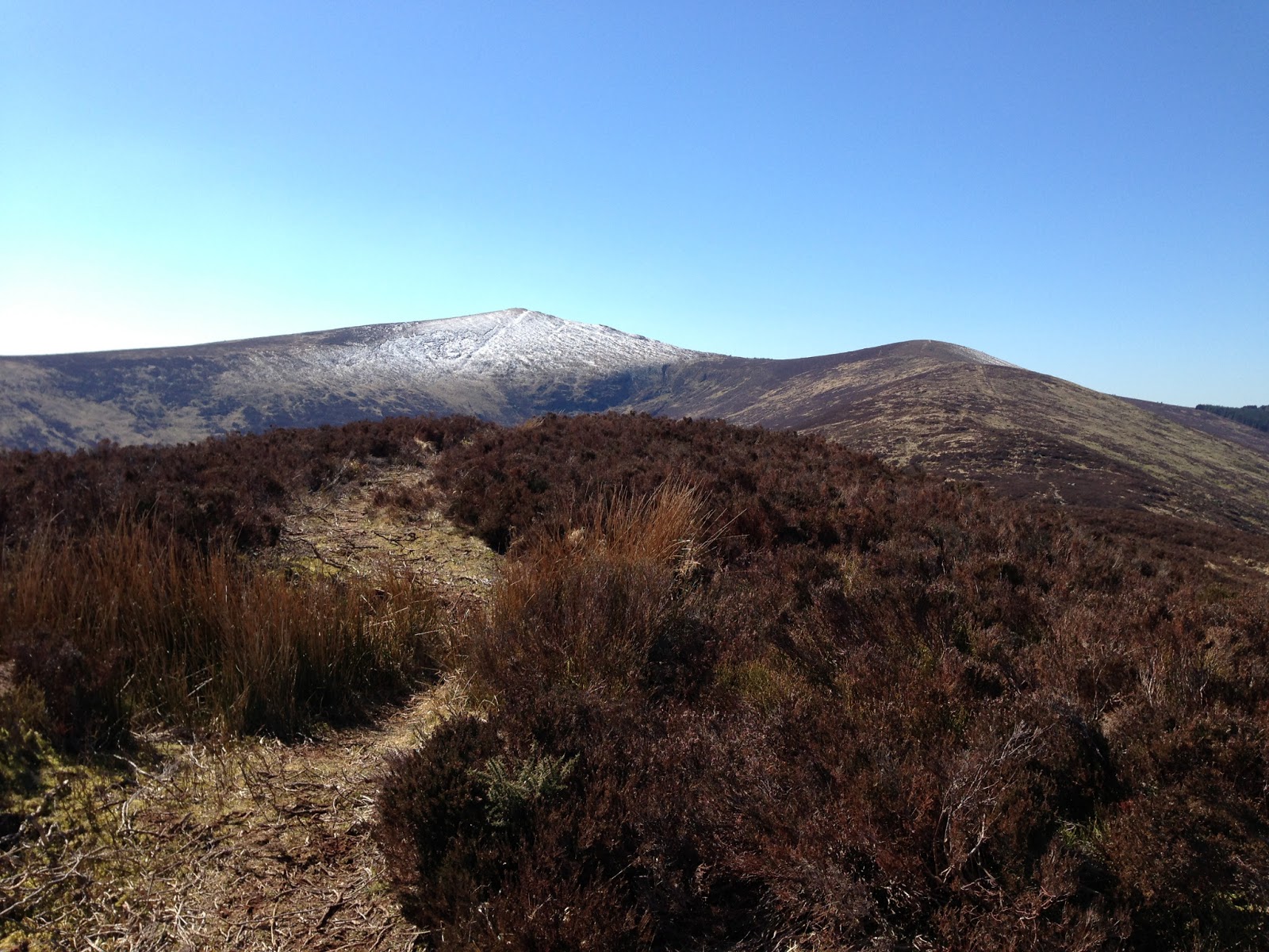
Mullaghcleevaun. I can see it from my house, but it doesn't pose any major threat. However, it is the 2nd highest peak in Wicklow, and I can see it from my house. Subject to all seasons on any given day, it is a beastly looking summit that casts a shadow over all of West Wicklow, and I've had my eye on it for some time. There is often a completely different weather system in effect up there, and it will definitely hold on to snow for much longer than the minnows in its kingdom. Yesterday, I slowly awoke from a good slumber to a beautiful looking day. Following a brief conference call in relation to the release of the MAGGY SIMPSON album, and realising there'd be no immediate movement on that, I decided I would put this great looking hill to bed.

There are a number of ways to tackle this mountain and I have been close to it before, on one of many trips to Black Hill. So, Black Hill was always going to be my launch pad. It's a nice easy 2km trek up from the Black Hill car park at the Ballynultagh Gap: broad, rocky, sandy pathway with a two-step gradual ascent. Even from this height (602m) you can get great 360 views ranging from Dublin to Laois. This hill is fairly featureless, but a great initiator for new hillwalkers and / or a great gateway to bigger and better things.

Mullaghcleevaun as viewed from Black Hill
Though I was unable to capture a suitably clear image, there were several adrenalin junkies working the airspace between Black Hill and Sorrel Hill, too. Some kind of base jumping to the best of my knowledge. Needless to say, it can get quite gusty in these parts and so perfect for this sport.

'cleevaun lies approximately 3km SE of Black Hill, and there is a bog path of sorts that will take you all the way to the top. Visibility provided no obstacle on the day, so no requirement for maps or compasses other than for security. As I said, things can change quickly at 849m. Only a small amount of peat hag scrambling is necessary at the foot of the mountain, but the summit can be reached with relative ease for someone of above average fitness (see below for my completely unofficial grading system!)

The peak itself is very broad and flat, with a number of excellent views available across the entire Wicklow / Dublin Mountains range, along with plenty of rest-stop options. I'd recommend going further onto Mullaghcleevaun East Top (also known as Stony Top) for lunch, though. Slightly better views, and as the name suggests, many more stones to choose from: some table shaped! Just be prepared to face the effects of over-farming peat. There are vast 'seas' of open bog of unknown depth, and very few hags to use as 'buoys'. Plan ahead, stay ashore and choose a route around these.

Blessington Lake as viewed from Mullaghcleevaun. Also looking down on Moanbane to the left, and Black Hill to the right

Lunch stop at Stony Top (Mullaghcleevaun East)

Looking back to Mullaghcleevaun from the East Top. Heavy scarring visible on the ridge between, and to the left of the summit
I took in the second 'top' at the East Top en route back to the Lough that sits beneath Mullaghcleevaun, before taking a straight bearing (yup, made use of the compass after all) back down into Ballynultagh Woods. The final few kms of my day were spent on typical forest trails and a short climb back up the road to the Black Hill car park, though there are any number of tracks that return you to the point of origin.

Mullaghcleevaun Lough
Distance: 16.46km
Highest Elevation: 849m
Climb: 453m
Duration: 5.5hrs inc. Lunch
Fitness Level: Slightly above average!

Friday, April 12, 2013

Views from a hill


I wondered if I would get my reward today. Setting out in very overcast conditions, and heading for even higher climes, today's venture may have ended with only exercise and challenge as the fruits of my labour. Anyone who knows me will know the vast natural views are a key part of why I do this...and the evening beers that follow. Oh, hell, there are any number of reasons for a solitary man such as myself!

Well, I started out along the St. Kevin's Way at Ballinagee Forest and traced the steps to the Wicklow Gap. Still no sunshine, but I could see the light desperately trying to break through. More hope than expectation at this point. The route up to the Gap is entirely pleasant: a genuine woodland walk, not one of those Coillte forest tracks that are somewhat sterile and functional. I really enjoyed this section as a suitable warm up for what was to come. The pathway weaves in and out of both the R758 (Gap Road) and The King's River, with only minimal road walking required at the final stretch.

Brunch! With view to Camaderry from Wicklow Gap
 After a brunch stop (yup, you can have brunch on hiking days!) near the main car park, I continued on up the ESB service road around Turlough Hill before departing civilisation for the next few hours. And this is where the fun starts. You're off the beaten paths now, and won't see anything discernibly traceable for some time. I took route one to Conavalla, mostly so I could avoid the scurrying orienteering types that were following then overtaking me. Nothing against their chosen exercise, but I'm here to enjoy the natural surroundings in peace, and I don't have much of a timetable. Turns out they were headed to Lough Ferrib - disappointed they must have been to realise I wasn't! Shouldn't have followed me, so! Now, this section of my chosen walk was fraught with trickery given the amount of snow still lying around. It is especially boggy in this area at the best of times, so one is forced to negotiate snow, granite, peat hags of massive proportions, under-ice streams and no end of random meltwater, plus wind chill factors of several degrees. Like I always say, this stuff is fun, fun, FUN all the way! Over my knees in snow on many more than several occasions I did get to Conavalla - a peak that has little to recommend it in itself, but does have great views to Lugnaquilla, into Glendalough, and back to the Tonelagee / Mullaghcleevaun stretch.

By now, I am very keen to lunch, but no suitable shelter can be gained, so I plod on to the Three Lakes, and eventually over to Art's Cross...and now I get my reward, as the sun comes out. Cornish Cove, Red Onion Chutney, Baked Ham on Granary Bread if you must know.


Tonelagee to Mullaghcleevaun (view from Art's Cross)

Stuck in the rut of peat hags and snow, I've still to take in a frozen Lough Ferrib (oh, yes, I went there in the end!), White Hill, and drop back down to Oakwood before meeting up with St. Kevin again.

Frozen Ferrib with view to Lugnaquilla

St Kevin's Way Marker
Once you leave Turlough Hill there is very little evidence of human activity throughout this whole rugged section. While at times it was very tough going today, there is much to recommend the area, and I'm surprised it doesn't get more visitors. Maybe in the fair weather, eh?

Distance: 23.15km
Highest Elevation: 732m
Climb: 491m
Duration: 7.5hrs inc. Lunch

Wednesday, April 3, 2013

The Four Tops (or Under the Shadow)

Today finally became the day that I got to venture out into the hills again. Weather being what it is, particularly in recent weeks, has meant I have not been brave (daft?) enough to tackle my preferred target. In fairness, I have also been very busy on a handful of musical endeavours, too. I guess the timing worked out all right in that respect.

Today was a day for sunscreen (almost!) even though temperatures barely got above freezing - windchill factor probably putting the feeling at -5 or so. Now, we all know a picture can ably supplant a thousand words so I promise to get to that part soon enough. However, I have to say that while I feel I have been on the ropes for the last 6 weeks or so, today I felt like I gave a few sneaky digs back, and that I really felt alive. Combined with the ongoing Maggy Simpson mixing sessions, today's outing has me thirsting for life again in a big way. I'm going to treat myself to some delicious craft beer later on, too!

I covered just shy of 12.5km on my route, visiting Fananierin, Croghanmoira (or Mottie) and Carrickashane. Yup, that's only 3 named 'tops', but Fananierin kinda has two discernible summits. All of these hills are set beyond the massive Lugnaquilla in the very southern part of Wicklow. The trek I chose follows very well marked tracks of varying quality, and overall this is a very pleasant and achievable walk for someone of average fitness. I met not a wandering soul out there on a Wednesday afternoon, however plenty of evidence exists to show that 'Mottie' especially has been traversed a good deal during the late snows we endured in March.

On with the show:


View to Fananierin (upper level) and Croghanmoira (left, centre, with snow!)


Croghanmoira Summit, looking back to Glenmalure Valley
Evidence of other life!

Imposing Lugnaquilla, as viewed from Fananierin


Distance: 12.45km
Highest Elevation: 649m
Climb: 367m
Duration: 4hrs inc. Lunch


Monday, March 11, 2013

VERMIN Track listing

My next solo collection of instrumental oddities will soon be available. Writing finished, Mixing in progress, Mastering and release details to follow. Once again, in the interests of keeping production costs to a minimum this will be a digital-only release.

Track listing:


Until later

Shane

Sunday, March 10, 2013

'People who do this for fun must be idiots!'

This is the bitter exclamation of a TV show contestant. I overheard it while said contestant was scaling a hill in the Brecon Beacons as she raced to avoid elimination. I sit here as the wind howls down our chimney and I'd be inclined to agree: current Real Feel of -4 as we prepare to get a light dusting of snow.

By way of trying to inject humour into one of our recent sojourns in the (very wet) rain I rehashed this quote, wondering if she had a point. Getting wet is part of the experience of hillwalking, especially in Ireland, but failing gear can put a serious dampener (!) on your progress and leaky boots are the worst.

The first quarter of the year is not really conducive to outdoor pursuits and my boots were just not cutting it in anything over 1mm of rain, so the past couple of months have been all about sourcing really decent replacements. After some amount of online research I reckoned on needing a pair of Meindl Burma Pros, or something of similar stature. After some amount of travelling, fitting, waiting, phoning, more waiting and finally purchasing, turns out I was right. Approximately 50km in and I am very close to recommending them. Simple design, sturdy materials, very comfy right out of the box (when paired with a top quality replacement insole).

So....onto the actual walks. In recent weeks the joy of setting off to some unknown (and known) places has offered great therapy when most needed. Here are some of the highlights:

One of our 'go-to' spots, because it is local and has great 360 views taking in the Poulaphouca reservoir, the Seefin / Seefingan / Seechon trio, Mullaghcleevaun, Moanbane and Turlough Hill.

Summit at Black Hill
I'm looking over the reservoir, but you can see Black Hill and a snow-capped Mullaghcleevaun

When venturing further afield we went to Glendalough to tackle Derrybawn and take the ridge across to Braigue Mountain. It was a beautiful day for walking and this was our view at lunchtime:

Upper Lake at Glendalough, shouldered by Camaderry (right, centre) and The Spink (left, foreground)

Getting a new map is something I look forward to with an unnatural enthusiasm. The map opens new possibilities and is like discovering a secret doorway. Out first opportunity to explore new terrain came with a trip to the infrequently visited Keadeen and nearby Carringbrack. I had viewed Keadeen from afar on visits to Lobawn and Pinnacle Mountain. It's a good looking mountain that really stands out in the flat lands near Baltinglass and Rathdangan. In addition to the classical look there are extensive remains of a Passage Grave at the summit:

Passage Grave at Keadeen's peak, with life-size map reader for perspective


Fairy Castle
Tibradden Mountain, a feature of The Dublin Mountains Way, is always very rewarding for its great views over the city and beyond. Plus there is a worthy chambered cairn at the peak, along with ancient stone engraving. We passed by there once again on our way to the famous Fairy Castle cairn at Two Rock Mountain.


Cairn at Cullentragh
Ordinarily, a trek in and around Cullentragh and Braigue Mountain would afford some lovely views to Mullacor, Lugnaquilla, Derrybawn and the like. Not on this day, though. This is where 'the idiots' were thwarted and the household's original pair of Meindls died an undignified death - after 1000km of service! All in all I've definitely enjoyed breaking in my new boots, the weekly routine of route planning and the unmistakable taste of coffee from a metal flask. Here's to at least another 950km and the accelerated bagging of more peaks. Rain or Shine.


Massive thanks to Aoife Brennan for the awesome photos!